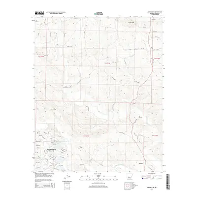
2014 Map of Lonsdale NE
USGS Topo · Published 2014About this map
The northern edge of Hot Springs Village meets the rising terrain of the Ouachita foothills in this modern topographic study of Saline County. The landscape is defined by the convergence of the Alum Fork Saline River and the Middle Fork Saline River as they wind through the valley south of Prillman Ridge. Settlement patterns show a distinct contrast between the planned residential streets of the village, such as Madrid Dr and Toledo Ln, and the established rural homesteads along Johnson Hwy and Ar-9. Local history is anchored by family and community landmarks including Wesleys Chapel Cem, Guerin Cem, and Bolin Cem. The presence of Weyerhaeuser Rd 24510 indicates the area's continued connection to the timber industry, while smaller routes like Malone Trl and Lewis Trl snake through the drainage basins of Lees Cr and Mill Cr.
Find a feature on this map
83 named features on this map. Tap any name to fly to it.
Don’t see what you’re looking for? This feature index may not catch every label — zoom into the map to look around manually.
Map Details
Editions of this 2014 Lonsdale NE Map
This is the sole edition of this map. No revisions or reprints were ever made.
Other maps of this area

1890 · Benton
USGS Topo · 1:125,000

1894 · Benton
USGS Topo · 1:125,000

1938 · Benton
USGS Topo · 1:48,000

1944 · Benton
USGS Topo · 1:62,500

1955 · Little Rock
USGS Topo · 1:250,000

1956 · Little Rock
USGS Topo · 1:250,000

1960 · Little Rock
USGS Topo · 1:250,000

1963 · Paron SW
USGS Topo · 1:24,000

1963 · Fourche SW
USGS Topo · 1:24,000

1963 · Paron
USGS Topo · 1:24,000