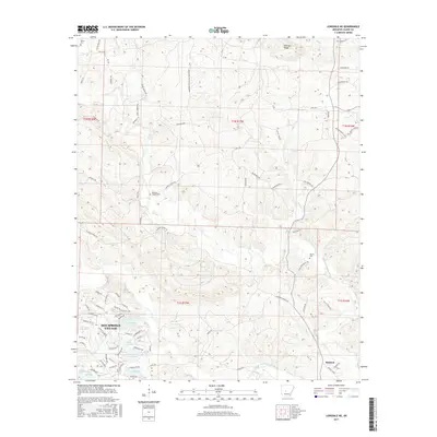
2017 Map of Lonsdale NE
USGS Topo · Published 2017About this map
The gated community of Hot Springs Village occupies the southwestern corner of this survey, showcasing its intricate network of man-made water features including Lake Granada, Lake Estrella, Lake Sophia, Lake Maria, and Lake Isabella. The landscape shifts rapidly to the east and north, moving into the more sparsely settled timberlands and river valleys of Saline County. The area is defined by its waterways, notably the Middle Fork Saline River and the Alum Fork Saline River, which cut through the undulating terrain below Prillman Ridge.
Find a feature on this map
87 named features on this map. Tap any name to fly to it.
Don’t see what you’re looking for? This feature index may not catch every label — zoom into the map to look around manually.
Map Details
Editions of this 2017 Lonsdale NE Map
This is the sole edition of this map. No revisions or reprints were ever made.
Other maps of this area

1890 · Benton
USGS Topo · 1:125,000

1894 · Benton
USGS Topo · 1:125,000

1938 · Benton
USGS Topo · 1:48,000

1944 · Benton
USGS Topo · 1:62,500

1955 · Little Rock
USGS Topo · 1:250,000

1956 · Little Rock
USGS Topo · 1:250,000

1960 · Little Rock
USGS Topo · 1:250,000

1963 · Paron SW
USGS Topo · 1:24,000

1963 · Fourche SW
USGS Topo · 1:24,000

1963 · Paron
USGS Topo · 1:24,000