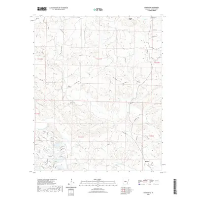
2020 Map of Lonsdale NE
USGS Topo · Published 2020About this map
The Middle Fork Saline River and the Alum Fork Saline River converge in this section of Saline County, defining a landscape of narrow ridges and winding creek valleys. Near the eastern edge, the settlement of Rubicon sits at the junction of several rural routes, including Chaney Rd and Bailey Cutoff. This 2020 record of the terrain preserves the locations of several important local landmarks for genealogists, such as Wesleys Chapel Cem, Geurin Cem, and Bolin Cem. The road network is heavily influenced by the timber industry and topography, featuring named tracks like Pulpwood Rd and Reece Ridge Rd that follow the contours of landforms such as Prillman Ridge. Higher elevations are also traversed by the Johnson Hwy, which provides a central corridor through this rural Arkansas interior.
Find a feature on this map
78 named features on this map. Tap any name to fly to it.
Don’t see what you’re looking for? This feature index may not catch every label — zoom into the map to look around manually.
Map Details
Editions of this 2020 Lonsdale NE Map
This is the sole edition of this map. No revisions or reprints were ever made.
Other maps of this area

1890 · Benton
USGS Topo · 1:125,000

1894 · Benton
USGS Topo · 1:125,000

1938 · Benton
USGS Topo · 1:48,000

1944 · Benton
USGS Topo · 1:62,500

1955 · Little Rock
USGS Topo · 1:250,000

1956 · Little Rock
USGS Topo · 1:250,000

1960 · Little Rock
USGS Topo · 1:250,000

1963 · Paron SW
USGS Topo · 1:24,000

1963 · Fourche SW
USGS Topo · 1:24,000

1963 · Paron
USGS Topo · 1:24,000