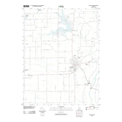
2010 Map of Loogootee
USGS Topo · Published 2010About this map
The Loogootee city grid serves as the primary hub of this Martin County landscape, where the agricultural plains are punctuated by the extensive waters of West Boggs Lake. Managed by the West Boggs Creek Dam, this reservoir dominates the northern terrain, creating a complex shoreline that contrasts with the straight-line county road network. To the south, the East Fork White River carves a winding path past Mount Pleasant, spanned by the Houghton Bridge near a cluster of family-named landmarks.
Find a feature on this map
52 named features on this map. Tap any name to fly to it.
Don’t see what you’re looking for? This feature index may not catch every label — zoom into the map to look around manually.
Map Details
Editions of this 2010 Loogootee Map
This is the sole edition of this map. No revisions or reprints were ever made.
Other maps of this area

1943 · Epsom
USGS Topo · 1:24,000

1944 · Montgomery
USGS Topo · 1:24,000

1944 · Glendale
USGS Topo · 1:24,000

1950 · Shoals
USGS Topo · 1:24,000

1950 · Odon
USGS Topo · 1:24,000

1956 · Alfordsville
USGS Topo · 1:24,000

1956 · Loogootee
USGS Topo · 1:24,000

1956 · Rusk
USGS Topo · 1:24,000

1956 · Indian Springs
USGS Topo · 1:24,000

1956 · Vincennes
USGS Topo · 1:250,000