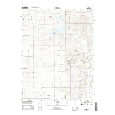
2016 Map of Loogootee
USGS Topo · Published 2016About this map
Loogootee serves as the central hub of this Indiana landscape, situated where the rolling hills of the southwest transition toward the fertile basins of the East Fork White River. The city is defined by a dense street grid including SW 2nd St and Walnut St, flanked by the outlying settlements of Cannelburg to the west and Mount Pleasant to the southeast. For genealogists, the map provides a high density of burial sites, from the centrally located Saint Johns Cem and Goodwill Cem to smaller family plots like Wagler Cem and Love Cem tucked into rural sections. Water management is a prominent feature of the terrain, evidenced by the Prairie Cr Structure Number A-2-1 and the expansive W Boggs Lake, which along with W Boggs Cr, shapes the hydrology north of the township boundaries.
Find a feature on this map
83 named features on this map. Tap any name to fly to it.
Don’t see what you’re looking for? This feature index may not catch every label — zoom into the map to look around manually.
Map Details
Editions of this 2016 Loogootee Map
This is the sole edition of this map. No revisions or reprints were ever made.
Other maps of this area

1943 · Epsom
USGS Topo · 1:24,000

1944 · Montgomery
USGS Topo · 1:24,000

1944 · Glendale
USGS Topo · 1:24,000

1950 · Shoals
USGS Topo · 1:24,000

1950 · Odon
USGS Topo · 1:24,000

1956 · Alfordsville
USGS Topo · 1:24,000

1956 · Loogootee
USGS Topo · 1:24,000

1956 · Rusk
USGS Topo · 1:24,000

1956 · Indian Springs
USGS Topo · 1:24,000

1956 · Vincennes
USGS Topo · 1:250,000