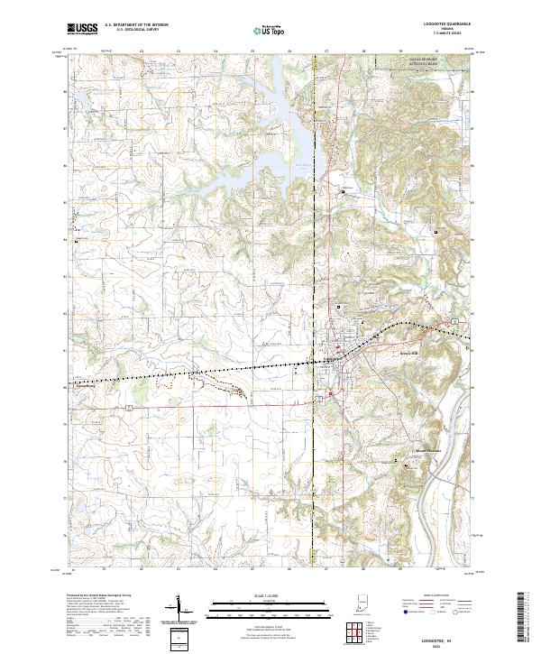
2022 Map of Loogootee
USGS Topo · Published 2022About this map
Loogootee serves as the primary hub of this landscape, situated along the Daviess and Martin county line. The town's grid is characterized by historic thoroughfares like E Broadway St and Church St, while the newer Bellgrade Addition extends to the northeast. To the north, the waters of West Boggs Lake dominate the terrain, managed by infrastructure including Prairie Cr Structure Number A-2-2. Local history and genealogy are well-represented by numerous family and community burial grounds, such as Goodwill Cem, Wagler Cem, and Love Cem, reflecting generations of settlement near the banks of Boggs Creek and Flat Cr. Further south, the rural character is maintained around Mount Pleasant and the high ground of Scenic Hill, eventually descending toward the East Fork White River at the map's southeastern edge.
Find a feature on this map
122 named features on this map. Tap any name to fly to it.
Don’t see what you’re looking for? This feature index may not catch every label — zoom into the map to look around manually.
Map Details
Editions of this 2022 Loogootee Map
This is the sole edition of this map. No revisions or reprints were ever made.
Other maps of this area

1943 · Epsom
USGS Topo · 1:24,000

1944 · Montgomery
USGS Topo · 1:24,000

1944 · Glendale
USGS Topo · 1:24,000

1950 · Shoals
USGS Topo · 1:24,000

1950 · Odon
USGS Topo · 1:24,000

1956 · Alfordsville
USGS Topo · 1:24,000

1956 · Loogootee
USGS Topo · 1:24,000

1956 · Rusk
USGS Topo · 1:24,000

1956 · Indian Springs
USGS Topo · 1:24,000

1956 · Vincennes
USGS Topo · 1:250,000