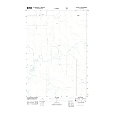
2011 Map of Lookout Butte
USGS Topo · Published 2011About this map
Communion Cemetery stands as a quiet focal point in this portion of the Porcupine District, set against a landscape defined by prominent landforms and winding waterways. The terrain is marked by distinct rises including Lookout Butte, Cedar Butte, and Smokey Butte, which provide natural landmarks across the rural prairie. The drainage pattern is established by the meandering path of Cedar Creek, which is joined by Plum Creek and Timber Creek as they move through the quadrangle. A structured grid of rural routes, including 90th St SW and 52nd Ave SW, provides access to these remote lands, reflecting the long-established section-line surveying of the North Dakota plains. The map offers a clear view of the sparse but deliberate human footprint in Sioux County during the early 21st century.
Find a feature on this map
14 named features on this map. Tap any name to fly to it.
Don’t see what you’re looking for? This feature index may not catch every label — zoom into the map to look around manually.
Map Details
Editions of this 2011 Lookout Butte Map
This is the sole edition of this map. No revisions or reprints were ever made.
Other maps of this area

1953 · McIntosh
USGS Topo · 1:250,000

1954 · Bismarck
USGS Topo · 1:250,000

1958 · Bismarck
USGS Topo · 1:250,000

1958 · McIntosh
USGS Topo · 1:250,000

1971 · Lookout Butte
USGS Topo · 1:24,000

1971 · Lookout Butte SE
USGS Topo · 1:24,000

1972 · Paradise Flats
USGS Topo · 1:24,000

1972 · Watauga
USGS Topo · 1:24,000

1972 · Hump Butte
USGS Topo · 1:24,000

1972 · McIntosh
USGS Topo · 1:24,000