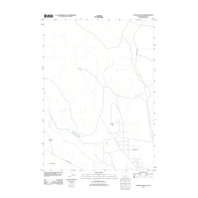
2012 Map of Lookout Butte SW
USGS Topo · Published 2012About this map
Steamboat Butte Oil Field anchors this portion of Fremont County, illustrating the intersection of energy production and a managed high-desert water system. The landscape is defined by its drainage and irrigation networks, where the winding path of Dry Cr and the functional Hayes Ditch feed into Hays Reservoir. These features reflect the long-standing efforts to harness the region's limited water resources for industrial and agricultural viability. Dominant terrain features like Stagner Ridge and Steamboat Butte provide significant topographical relief, while Mexican Draw cuts through the territory. The presence of Steamboat Geyser suggests the geothermal activity typical of this Wyoming corridor, accessible via local routes like Maverick Spring Rd and Lenore Bridge Rd.
Find a feature on this map
10 named features on this map. Tap any name to fly to it.
Don’t see what you’re looking for? This feature index may not catch every label — zoom into the map to look around manually.
Map Details
Editions of this 2012 Lookout Butte SW Map
This is the sole edition of this map. No revisions or reprints were ever made.
Other maps of this area

1951 · Lookout Butte SW
USGS Topo · 1:24,000

1951 · Eagle Point
USGS Topo · 1:24,000

1951 · Morton
USGS Topo · 1:24,000

1951 · Bull Lake East
USGS Topo · 1:24,000

1951 · Lookout Butte
USGS Topo · 1:24,000

1951 · Argo Butte
USGS Topo · 1:24,000

1951 · Maverick Spring
USGS Topo · 1:24,000

1952 · Crowheart Butte
USGS Topo · 1:24,000

1952 · Crowheart NE
USGS Topo · 1:24,000

1955 · Thermopolis
USGS Topo · 1:250,000