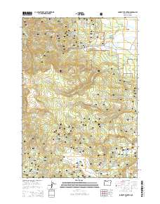
2014 Map of Lookout Mountain
USGS Topo · Published 2014About this map
The Ochoco National Forest dominates this high-elevation landscape in Central Oregon, characterized by its complex network of creeks and volcanic landforms. The high meadows of Big Summit Prairie and the lower Gray Prairie provide distinct ecological pockets among the peaks of the Ochoco Mountains. Notable summits such as Winter Butte, Lookout Mtn, and South Point define the local relief, while dozens of named springs like Kyle Spring, Crow Spring, and Kemp Spring indicate the critical role of water in this arid highland environment. A system of Forest Service routes, including the Natl Forest Develop Road 300 RD and Lookout Mountain Rd, provides access to these timberlands. The drainage pattern is led by Lookout Cr and Johnson Cr, which flow through the varied terrain of Horse Gulch and past the small Lost Spring Reservoir.
Find a feature on this map
51 named features on this map. Tap any name to fly to it.
Don’t see what you’re looking for? This feature index may not catch every label — zoom into the map to look around manually.
Map Details
Editions of this 2014 Lookout Mountain Map
This is the sole edition of this map. No revisions or reprints were ever made.
Other maps of this area

1951 · Post
USGS Topo · 1:62,500

1951 · Lookout Mtn
USGS Topo · 1:62,500

1955 · Bend
USGS Topo · 1:250,000

1957 · Bend
USGS Topo · 1:250,000

1958 · Bend
USGS Topo · 1:250,000

1965 · Williams Prairie
USGS Topo · 1:24,000

1966 · Mt. Pisgah
USGS Topo · 1:24,000

1981 · Prineville
USGS Topo · 1:100,000
1983 · Committee Creek
USGS Topo · 1:24,000
1990 · Lookout Mountain
USGS Topo · 1:24,000