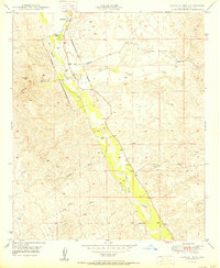
1950 Map of Lookout Mtn
USGS Topo · Published 1950About this map
The Old Camp Grant Military Reservation (Aban'd) footprint marks this 1950 survey of the Pinal County desert, showing the historical intersection of military presence and ranching life. The San Pedro River valley serves as the primary corridor, where the PZ Ranch and numerous unnamed wells and tanks suggest the critical importance of water management in this arid landscape. To the north, Cooks Lake sits near the river's path, while the prominent peak of Lookout Mtn rises to the west, overlooking the drainage patterns of Putnam Wash.
Find a feature on this map
16 named features on this map. Tap any name to fly to it.
Don’t see what you’re looking for? This feature index may not catch every label — zoom into the map to look around manually.
Map Details
Editions of this 1950 Lookout Mtn Map
This is the sole edition of this map. No revisions or reprints were ever made.
Other maps of this area

1911 · Winkelman
USGS Topo · 1:125,000

1913 · Winkelman
USGS Topo · 1:125,000

1948 · Clark Ranch
USGS Topo · 1:24,000

1948 · Mammoth
USGS Topo · 1:62,500

1948 · Mammoth
USGS Topo · 1:24,000

1949 · Clark Ranch
USGS Topo · 1:24,000

1949 · Mammoth
USGS Topo · 1:24,000

1949 · Holy Joe Peak
USGS Topo · 1:62,500

1949 · Winkelman
USGS Topo · 1:24,000

1949 · Winkelman
USGS Topo · 1:62,500