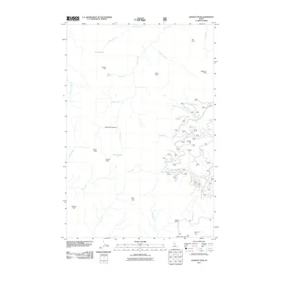
2011 Map of Lookout Peak
USGS Topo · Published 2011About this map
Lookout Peak and the surrounding high country of Idaho County define this landscape, where a network of peaks and saddles shaped early travel and seasonal camps. The terrain is marked by significant hydrological features including Lookout Lake, Monroe Lake, and Gem Lake, which feed a complex system of drainages such as Monroe Creek and Lookout Creek. Established encampments like Little Cabin Meadows and Windy Ridge Camp indicate the area's importance for forest management or backcountry recreation. Traces of historical movement are evident in the Lolo Trl, which traverses the southern portion of the map near Indian Grave Peak. Numerous forestry and access roads, including Mire Creek Rd, navigate the ridges and slopes, connecting landmarks like 12 Mile Saddle and Marten Hill to the various creek basins below.
Find a feature on this map
64 named features on this map. Tap any name to fly to it.
Don’t see what you’re looking for? This feature index may not catch every label — zoom into the map to look around manually.
Map Details
Editions of this 2011 Lookout Peak Map
This is the sole edition of this map. No revisions or reprints were ever made.
Other maps of this area

1911 · Lolo
USGS Topo · 1:250,000

1913 · Lolo
USGS Topo · 1:250,000

1956 · Hamilton
USGS Topo · 1:250,000

1959 · Hamilton
USGS Topo · 1:250,000

1960 · Hamilton
USGS Topo · 1:250,000

1964 · Hamilton
USGS Topo · 1:250,000

1965 · Junction Mtn
USGS Topo · 1:24,000

1965 · Scurvy Mtn.
USGS Topo · 1:24,000

1965 · Gorman Hill
USGS Topo · 1:24,000

1965 · Lookout Peak
USGS Topo · 1:24,000