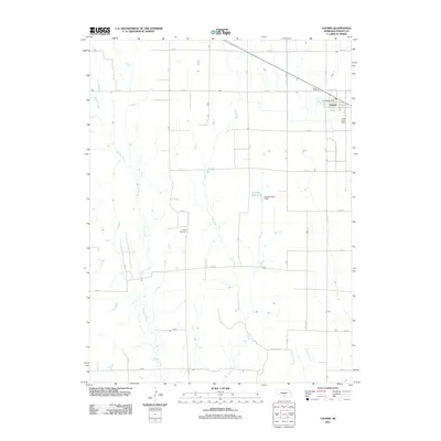
2011 Map of Loomis
USGS Topo · Published 2011About this map
Loomis sits at the northeastern corner of this Phelps County landscape, defined by the intersection of rural section roads and the local railway line. The village center is anchored by the Loomis Post Office, while the surrounding agricultural plains are marked by family-named landmarks like Linder Stock Farms. The geography is etched by several north-flowing drainages, including Spring Creek, Elm Creek, and Deep Creek, which dictate the placement of early infrastructure. A notable water management feature, the Johnson Reservoir and its associated Johnson Dam-1 Dam, serves as a key topographical focal point. For those researching local heritage, the Shaw Cemetery remains a significant site within the grid of numbered roads such as 732 RD and 730 RD, illustrating the enduring spatial organization of this farming community.
Find a feature on this map
22 named features on this map. Tap any name to fly to it.
Don’t see what you’re looking for? This feature index may not catch every label — zoom into the map to look around manually.
Map Details
Editions of this 2011 Loomis Map
This is the sole edition of this map. No revisions or reprints were ever made.
Other maps of this area

1896 · Lexington
USGS Topo · 1:125,000

1896 · Holdrege
USGS Topo · 1:125,000

1896 · Kearney
USGS Topo · 1:125,000

1896 · Arapahoe
USGS Topo · 1:125,000

1898 · Arapahoe
USGS Topo · 1:125,000

1899 · Lexington
USGS Topo · 1:125,000

1955 · Grand Island
USGS Topo · 1:250,000

1957 · Grand Island
USGS Topo · 1:250,000

1958 · Grand Island
USGS Topo · 1:250,000

1958 · Mascot
USGS Topo · 1:24,000