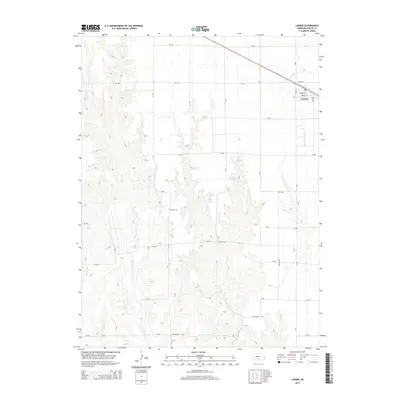
2014 Map of Loomis
USGS Topo · Published 2014About this map
Loomis serves as the primary hub in this Phelps County landscape, defined by a grid of rural roads and the drainage patterns of Spring Cr and Elm Cr. The village is meticulously detailed, showing local thoroughfares like Ludeke St and Pacific St. Just to the west, the winding contours of the creek beds contrast with the sharp linear geometry of the surrounding agricultural sections. Local history and genealogy researchers will find Shaw Cem located near the center of the quadrangle, while the presence of Johnson Reservoir and the headwaters of Deep Cr highlight the vital role of water management in this portion of the Nebraska plains. This survey documents the intersection of rural life and natural topography, from the residential streets of the town to the outlying reaches of Rock Falls Rd.
Find a feature on this map
21 named features on this map. Tap any name to fly to it.
Don’t see what you’re looking for? This feature index may not catch every label — zoom into the map to look around manually.
Map Details
Editions of this 2014 Loomis Map
This is the sole edition of this map. No revisions or reprints were ever made.
Other maps of this area

1896 · Lexington
USGS Topo · 1:125,000

1896 · Holdrege
USGS Topo · 1:125,000

1896 · Kearney
USGS Topo · 1:125,000

1896 · Arapahoe
USGS Topo · 1:125,000

1898 · Arapahoe
USGS Topo · 1:125,000

1899 · Lexington
USGS Topo · 1:125,000

1955 · Grand Island
USGS Topo · 1:250,000

1957 · Grand Island
USGS Topo · 1:250,000

1958 · Grand Island
USGS Topo · 1:250,000

1958 · Mascot
USGS Topo · 1:24,000