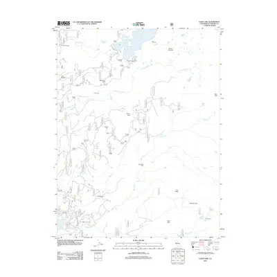
2012 Map of Loon Lake
USGS Topo · Published 2012About this map
Loon Lake and its high-elevation surroundings in El Dorado County are defined by a complex network of seasonal camps and ranching outposts. This 2012 survey documents the persistent human presence in the Sierra Nevada, from the historic Francis Cow Camp in the north to Rupley Cabin in the southeast. The landscape is a mix of alpine basins and granite bluffs, where the S Fork Rubicon River and Bassi Fork navigate the drainage between peaks like Tells Peak and Brown Mountain. Evidence of early twentieth-century activity remains visible through named landmarks such as Stone Cellar and Millionaire Camp, while the Union Valley Reservoir highlights the region's importance for water management. Researchers can trace the rugged topography of Chipmunk Bluff and Slick Rock alongside the forest road system, including Ice House Rd.
Find a feature on this map
34 named features on this map. Tap any name to fly to it.
Don’t see what you’re looking for? This feature index may not catch every label — zoom into the map to look around manually.
Map Details
Editions of this 2012 Loon Lake Map
This is the sole edition of this map. No revisions or reprints were ever made.
Other maps of this area

1889 · Pyramid Peak
USGS Topo · 1:125,000

1891 · Truckee
USGS Topo · 1:125,000

1891 · Pyramid Peak
USGS Topo · 1:125,000

1893 · Truckee
USGS Topo · 1:125,000

1895 · Pyramid Peak
USGS Topo · 1:125,000

1895 · Truckee
USGS Topo · 1:125,000

1896 · Pyramid Peak
USGS Topo · 1:125,000

1932 · Truckee
USGS Topo · 1:96,000

1940 · Truckee
USGS Topo · 1:125,000

1947 · Sacramento
USGS Topo · 1:250,000