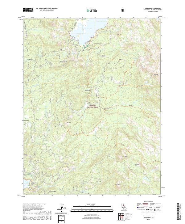
2021 Map of Loon Lake
USGS Topo · Published 2021About this map
Loon Lake and the Union Valley Reservoir anchor this high-elevation landscape within the Eldorado National Forest. The map documents a dense network of backcountry routes, including the historic Rubicon Trl, which winds past features like Chipmunk Bluff and the S Fork Rubicon River. The terrain is defined by dramatic granite formations such as Sun Rock, Slick Rock, and the eastern Crystal Range, punctuated by remote high-country meadows and flats.
Find a feature on this map
51 named features on this map. Tap any name to fly to it.
Don’t see what you’re looking for? This feature index may not catch every label — zoom into the map to look around manually.
Map Details
Editions of this 2021 Loon Lake Map
This is the sole edition of this map. No revisions or reprints were ever made.
Other maps of this area

1889 · Pyramid Peak
USGS Topo · 1:125,000

1891 · Truckee
USGS Topo · 1:125,000

1891 · Pyramid Peak
USGS Topo · 1:125,000

1893 · Truckee
USGS Topo · 1:125,000

1895 · Pyramid Peak
USGS Topo · 1:125,000

1895 · Truckee
USGS Topo · 1:125,000

1896 · Pyramid Peak
USGS Topo · 1:125,000

1932 · Truckee
USGS Topo · 1:96,000

1940 · Truckee
USGS Topo · 1:125,000

1947 · Sacramento
USGS Topo · 1:250,000