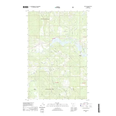
2020 Map of Loon Lake
USGS Topo · Published 2020About this map
Kootenai National Forest dominates this section of northwestern Montana, where a dense network of forest development roads provides access to the high-country basins and lakes of the Fisher River drainage. The small settlement at Happys Inn serves as a local hub near the shores of Upper Thompson Lake and Rainbow Lake. This area represents a transition from high-elevation timberland to the open clearings of Elk Park and McGinnis Meadows in the southern half of the quadrangle.
Find a feature on this map
41 named features on this map. Tap any name to fly to it.
Don’t see what you’re looking for? This feature index may not catch every label — zoom into the map to look around manually.
Map Details
Editions of this 2020 Loon Lake Map
This is the sole edition of this map. No revisions or reprints were ever made.
Other maps of this area

1920 · Jennings
USGS Topo · 1:125,000

1935 · Thompson Lakes
USGS Topo · 1:96,000

1937 · Thompson Falls
USGS Topo · 1:125,000

1942 · Thompson Lakes
USGS Topo · 1:125,000

1956 · Wallace
USGS Topo · 1:250,000

1957 · Kalispell
USGS Topo · 1:250,000

1960 · Kalispell
USGS Topo · 1:250,000

1960 · Wallace
USGS Topo · 1:250,000

1961 · Kalispell
USGS Topo · 1:250,000
1966 · Fisher Mountain
USGS Topo · 1:24,000