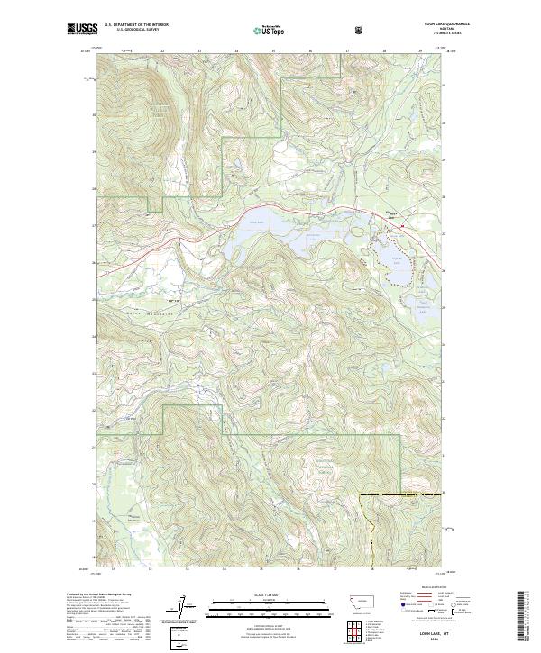
2024 Map of Loon Lake
USGS Topo · Published 2024About this map
Kootenai National Forest dominates this section of northwest Montana, where a dense network of glacial lakes and mountain drainages defines the landscape. The settlement of Happys Inn sits as a central landmark near the shores of Loon Lake, Lavon Lake, and Crystal Lake. This area serves as a significant hydrological junction where the Pleasant Valley-Fisher River system meets numerous smaller bodies of water like Lilypad Lake and Horseshoe Lake.
Find a feature on this map
47 named features on this map. Tap any name to fly to it.
Don’t see what you’re looking for? This feature index may not catch every label — zoom into the map to look around manually.
Map Details
Editions of this 2024 Loon Lake Map
This is the sole edition of this map. No revisions or reprints were ever made.
Other maps of this area

1920 · Jennings
USGS Topo · 1:125,000

1935 · Thompson Lakes
USGS Topo · 1:96,000

1937 · Thompson Falls
USGS Topo · 1:125,000

1942 · Thompson Lakes
USGS Topo · 1:125,000

1956 · Wallace
USGS Topo · 1:250,000

1957 · Kalispell
USGS Topo · 1:250,000

1960 · Kalispell
USGS Topo · 1:250,000

1960 · Wallace
USGS Topo · 1:250,000

1961 · Kalispell
USGS Topo · 1:250,000
1966 · Fisher Mountain
USGS Topo · 1:24,000