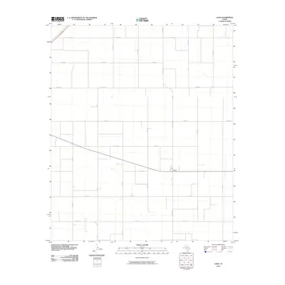
2010 Map of Loop
USGS Topo · Published 2010About this map
Loop serves as the central hub of this agricultural landscape in Gaines County, situated at the intersection of several key rural thoroughfares. The settlement pattern is defined by a rigorous grid of section lines and county roads, reflecting the organized land management of the Texas South Plains. Significant transport routes like Ranch Rd 303 and Co Rd 128 cut through the territory, linking isolated farmsteads and ranching operations. The terrain is notably level, marked by intermittent playa lakes and a dense network of local roads including Co Rd 670 and Co Rd 680. This survey illustrates the persistent rural character of the region in the early 21st century, where the economy remains tied to the surrounding acreage and the small-town core of the community.
Find a feature on this map
20 named features on this map. Tap any name to fly to it.
Don’t see what you’re looking for? This feature index may not catch every label — zoom into the map to look around manually.
Map Details
Editions of this 2010 Loop Map
This is the sole edition of this map. No revisions or reprints were ever made.
Other maps of this area

1954 · Hobbs
USGS Topo · 1:250,000

1954 · Brownfield
USGS Topo · 1:250,000

1958 · Brownfield
USGS Topo · 1:250,000

1958 · Hobbs
USGS Topo · 1:250,000

1962 · Brownfield
USGS Topo · 1:250,000

1969 · Foster
USGS Topo · 1:24,000

1969 · Loop
USGS Topo · 1:24,000

1969 · Ashmore
USGS Topo · 1:24,000

1969 · Wellman
USGS Topo · 1:24,000

1970 · Seagraves SE
USGS Topo · 1:24,000