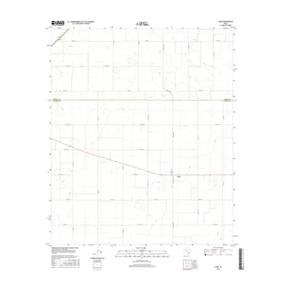
2016 Map of Loop
USGS Topo · Published 2016About this map
Loop sits at the intersection of several critical West Texas transport corridors, including Ranch Rd 303 and Fate St, serving as a central hub for the surrounding agricultural plains. This survey, conducted in the mid-2010s, illustrates the highly organized grid of county roads that define the landscape, such as Co Rd 130 and Co Rd 128, which facilitate movement between rural farmsteads and the town center. The settlement features a central Po, a common anchor for these semi-rural communities. Straddling the boundary between Terry Co and Gaines Co, the area is characterized by scattered wetlands and the subtle elevation changes of the High Plains, providing a clear view of the regional infrastructure before further modern development.
Find a feature on this map
23 named features on this map. Tap any name to fly to it.
Don’t see what you’re looking for? This feature index may not catch every label — zoom into the map to look around manually.
Map Details
Editions of this 2016 Loop Map
This is the sole edition of this map. No revisions or reprints were ever made.
Other maps of this area

1954 · Hobbs
USGS Topo · 1:250,000

1954 · Brownfield
USGS Topo · 1:250,000

1958 · Brownfield
USGS Topo · 1:250,000

1958 · Hobbs
USGS Topo · 1:250,000

1962 · Brownfield
USGS Topo · 1:250,000

1969 · Foster
USGS Topo · 1:24,000

1969 · Loop
USGS Topo · 1:24,000

1969 · Ashmore
USGS Topo · 1:24,000

1969 · Wellman
USGS Topo · 1:24,000

1970 · Seagraves SE
USGS Topo · 1:24,000