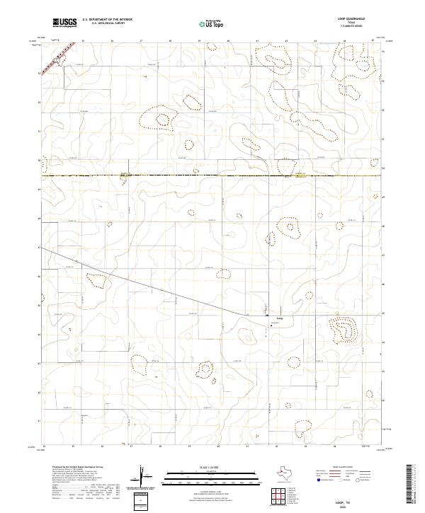
2022 Map of Loop
USGS Topo · Published 2022About this map
The settlement of Loop sits at the heart of this West Texas landscape, where a precise grid of county roads meets the state highway system. Located at the intersection of Ranch Rd 303 and Highway 83, the community is defined by its agricultural layout and proximity to the Terry Co and Gaines Co line. Local history is anchored at the Loop Cem, situated just south of the main crossroads and the residential stretch of Tate St. The surrounding terrain is marked by the systematic organization of rural routes, including Co Rd 128 and Co Rd 130, which support the region's ranching and farming economy. This survey documents the area's infrastructure as it stood in the early twenty-first century, showing the enduring footprint of this isolated High Plains community.
Find a feature on this map
23 named features on this map. Tap any name to fly to it.
Don’t see what you’re looking for? This feature index may not catch every label — zoom into the map to look around manually.
Map Details
Editions of this 2022 Loop Map
This is the sole edition of this map. No revisions or reprints were ever made.
Other maps of this area

1954 · Hobbs
USGS Topo · 1:250,000

1954 · Brownfield
USGS Topo · 1:250,000

1958 · Brownfield
USGS Topo · 1:250,000

1958 · Hobbs
USGS Topo · 1:250,000

1962 · Brownfield
USGS Topo · 1:250,000

1969 · Foster
USGS Topo · 1:24,000

1969 · Loop
USGS Topo · 1:24,000

1969 · Ashmore
USGS Topo · 1:24,000

1969 · Wellman
USGS Topo · 1:24,000

1970 · Seagraves SE
USGS Topo · 1:24,000