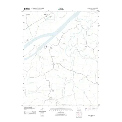
2012 Map of Loose Creek
USGS Topo · Published 2012About this map
The confluence of the Osage River and the Missouri River anchors this landscape, where the flat alluvial plain of Cote Sans Dessein Prairie meets the rising bluffs of central Missouri. The village of Bonnots Mill sits at the river junction, a historical point of transport and commerce near Dodds Island. Inland, the settlement of Loose Creek and the hilltop community of Frankenstein are connected by a network of rural roads such as Co Rd 425 and Co Hwy 401. Local genealogy is well-documented through several parish and family burial grounds, including Our Lady of Help Cemetery and the Immaculate Conception Cemetery. The terrain is deeply etched by a drainage network of creeks like Cedar Creek and Krautman Creek, illustrating the transition from the river bottomlands to the rolling interior uplands.
Find a feature on this map
75 named features on this map. Tap any name to fly to it.
Don’t see what you’re looking for? This feature index may not catch every label — zoom into the map to look around manually.
Map Details
Editions of this 2012 Loose Creek Map
This is the sole edition of this map. No revisions or reprints were ever made.
Other maps of this area

1886 · Jefferson City
USGS Topo · 1:125,000

1888 · Tuscumbia
USGS Topo · 1:125,000

1890 · Fulton
USGS Topo · 1:125,000

1894 · Tuscumbia
USGS Topo · 1:125,000

1894 · Jefferson City
USGS Topo · 1:125,000

1934 · Linn
USGS Topo · 1:48,000

1939 · Jefferson City
USGS Topo · 1:62,500

1942 · Jefferson City
USGS Topo · 1:62,500

1942 · Linn
USGS Topo · 1:62,500

1945 · Mokane
USGS Topo · 1:62,500