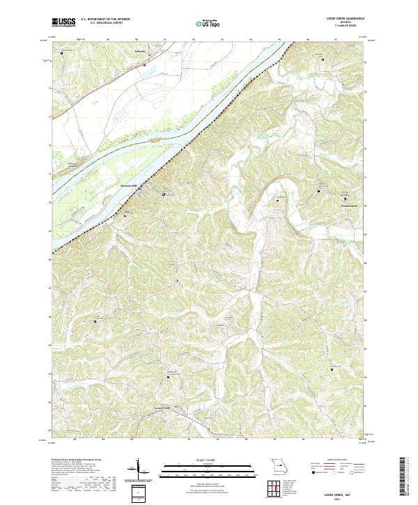
2021 Map of Loose Creek
USGS Topo · Published 2021About this map
The confluence of the Osage River and the Missouri River defines this landscape in Osage and Callaway counties, where riverfront settlements like Bonnots Mill and Cote Sans Dessein historically relied on the water for transport and trade. This 2021 survey reveals a deeply etched topography of ridges and hollows, home to numerous small communities such as Frankenstein and Loose Creek. The abundance of local cemeteries, including Immaculate Conception Cem, Our Lady of Help Parish Cem, and Saint Louis Cem, provides a detailed record of the families who settled this rugged corner of Missouri. To the north, across the Missouri River, the Katy Trl follows the old rail corridor through Tebbetts, tracing a path along the base of the river bluffs. Numerous creeks such as Cedar Creek, Maasen Cr, and Huesgen Cr drain into the primary river systems, shaping a complex network of valleys that have dictated local road patterns for generations.
Find a feature on this map
95 named features on this map. Tap any name to fly to it.
Don’t see what you’re looking for? This feature index may not catch every label — zoom into the map to look around manually.
Map Details
Editions of this 2021 Loose Creek Map
This is the sole edition of this map. No revisions or reprints were ever made.
Other maps of this area

1886 · Jefferson City
USGS Topo · 1:125,000

1888 · Tuscumbia
USGS Topo · 1:125,000

1890 · Fulton
USGS Topo · 1:125,000

1894 · Tuscumbia
USGS Topo · 1:125,000

1894 · Jefferson City
USGS Topo · 1:125,000

1934 · Linn
USGS Topo · 1:48,000

1939 · Jefferson City
USGS Topo · 1:62,500

1942 · Jefferson City
USGS Topo · 1:62,500

1942 · Linn
USGS Topo · 1:62,500

1945 · Mokane
USGS Topo · 1:62,500