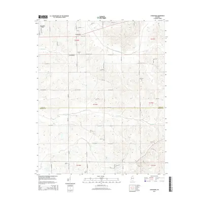
2015 Map of Looxahoma
USGS Topo · Published 2015About this map
Looxahoma and the surrounding rural landscape sit at the northern edge of the Tate Co Panola Co line, characterized by a dense network of country roads and family-named landmarks. The area is heavily marked by its local heritage, with numerous burial grounds such as Saint Maria Cem, Beulah Cem, and Fredonia Cem punctuating the terrain. Waterways like Senatobia Cr and the James Wolf Canal define the drainage of this agricultural region, while smaller settlements like Crossroad link the community via routes such as Looxahoma-Tyro Rd and Dandridge Rd. The presence of Senatobia Lakes in the northwest corner suggests a focus on local water management and recreation within this traditional Mississippi hill country environment, where land divisions follow the Public Land Survey System as indicated by the township and range markers like t6s r6w.
Find a feature on this map
68 named features on this map. Tap any name to fly to it.
Don’t see what you’re looking for? This feature index may not catch every label — zoom into the map to look around manually.
Map Details
Editions of this 2015 Looxahoma Map
This is the sole edition of this map. No revisions or reprints were ever made.
Other maps of this area

1940 · Oxford
USGS Topo · 1:62,500

1943 · Oxford
USGS Topo · 1:62,500

1944 · Senatobia
USGS Topo · 1:62,500

1944 · Tyro
USGS Topo · 1:62,500

1952 · Sardis
USGS Topo · 1:62,500

1953 · Sardis
USGS Topo · 1:62,500

1956 · Tupelo
USGS Topo · 1:250,000

1958 · Tupelo
USGS Topo · 1:250,000

1971 · Wyatte
USGS Topo · 1:24,000
1971 · Tyro
USGS Topo · 1:24,000