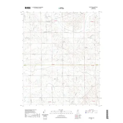
2021 Map of Looxahoma
USGS Topo · Published 2021About this map
Looxahoma and the surrounding rural landscape of northern Mississippi are defined by a complex network of creeks and small family-named roads. This modern survey illustrates the persistent agricultural and residential patterns of the region, where community life centers on historic sites like Looxahoma Cem and Saint Maria Cem. The terrain is characterized by the winding courses of Senatobia Creek and Bates Creek, alongside the engineered path of the James Wolf Canal. These waterways dictate the placement of local thoroughfares such as Lyles Road and Crockett Road. Genealogical interest is particularly high here, with numerous burial sites including Beulah Cemetery and Ebenezer Cemetery scattered across the Tate and Panola County line, providing a clear record of the area's ancestral settlements and church-centered neighborhoods.
Find a feature on this map
71 named features on this map. Tap any name to fly to it.
Don’t see what you’re looking for? This feature index may not catch every label — zoom into the map to look around manually.
Map Details
Editions of this 2021 Looxahoma Map
This is the sole edition of this map. No revisions or reprints were ever made.
Other maps of this area

1940 · Oxford
USGS Topo · 1:62,500

1943 · Oxford
USGS Topo · 1:62,500

1944 · Senatobia
USGS Topo · 1:62,500

1944 · Tyro
USGS Topo · 1:62,500

1952 · Sardis
USGS Topo · 1:62,500

1953 · Sardis
USGS Topo · 1:62,500

1956 · Tupelo
USGS Topo · 1:250,000

1958 · Tupelo
USGS Topo · 1:250,000

1971 · Wyatte
USGS Topo · 1:24,000
1971 · Tyro
USGS Topo · 1:24,000