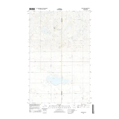
2014 Map of Lords Lake
USGS Topo · Published 2014About this map
Butte Saint Paul stands as a prominent elevation within the Turtle Mountains, overlooking a landscape defined by glacial depressions and prairie potholes along the border of Bottineau and Rolette counties. This 2014 survey captures the hydrological character of the region, where water bodies like Lords Lake and Butte Lake dominate the terrain. The northern section of the map reveals the complex drainage patterns of Willow Cr and Platte Lake, set against a geometric grid of rural section roads. The crossing of ND-5 through the lower half of the quadrangle serves as the primary east-west corridor, connecting the scattered wetlands and hills of this distinctive North Dakota upland.
Find a feature on this map
23 named features on this map. Tap any name to fly to it.
Don’t see what you’re looking for? This feature index may not catch every label — zoom into the map to look around manually.
Map Details
Editions of this 2014 Lords Lake Map
This is the sole edition of this map. No revisions or reprints were ever made.
Other maps of this area

1935 · Dunseith
USGS Topo · 1:48,000

1939 · Dunseith
USGS Topo · 1:62,500

1954 · Omemee
USGS Topo · 1:24,000

1954 · Minot
USGS Topo · 1:250,000

1955 · Fonda
USGS Topo · 1:24,000

1955 · Lords Lake
USGS Topo · 1:24,000

1955 · Dunseith
USGS Topo · 1:24,000

1955 · Overly
USGS Topo · 1:24,000

1955 · Bottineau SE
USGS Topo · 1:24,000

1956 · Metigoshe Lake
USGS Topo · 1:24,000