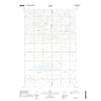
2017 Map of Lords Lake
USGS Topo · Published 2017About this map
Butte Saint Paul stands as a prominent landmark within the Turtle Mountains, marking the transition between the elevated woodland terrain and the pothole-strewn plains of the North Dakota borderlands. This high-resolution survey reveals a landscape dominated by glacial depressions and water bodies, centered around the expansive Lords Lake. The map details the precise section lines and rural road network, including Co Rd 57 and several numbered township roads like 96th St NE, which define the agricultural grid typical of Rolette and Bottineau counties. The drainage pattern is dictated by small, winding waterways such as Willow Cr and Miller Cr, which connect various wetlands and smaller lakes like Platte Lake and Butte Lake. This 2017 edition documents the contemporary hydrography and topography of this unique northern prairie plateau.
Find a feature on this map
25 named features on this map. Tap any name to fly to it.
Don’t see what you’re looking for? This feature index may not catch every label — zoom into the map to look around manually.
Map Details
Editions of this 2017 Lords Lake Map
This is the sole edition of this map. No revisions or reprints were ever made.
Other maps of this area

1935 · Dunseith
USGS Topo · 1:48,000

1939 · Dunseith
USGS Topo · 1:62,500

1954 · Omemee
USGS Topo · 1:24,000

1954 · Minot
USGS Topo · 1:250,000

1955 · Fonda
USGS Topo · 1:24,000

1955 · Lords Lake
USGS Topo · 1:24,000

1955 · Dunseith
USGS Topo · 1:24,000

1955 · Overly
USGS Topo · 1:24,000

1955 · Bottineau SE
USGS Topo · 1:24,000

1956 · Metigoshe Lake
USGS Topo · 1:24,000