
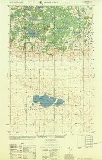
1955 Map of Lords Lake
USGS Topo · Published 1956About this map
The Turtle Mountains dominate the northern half of this landscape, rising above the prairie with a dense network of small lakes and wooded knolls. At the heart of this elevated terrain sits Butte St Paul and the adjacent Butte St Paul Historic Site, a significant regional landmark. The transition from these uplands to the southern plains is marked by a sharp topographic change where the drainage of Willow Creek begins to wind through the flats.
Find a feature on this map
16 named features on this map. Tap any name to fly to it.
Don’t see what you’re looking for? This feature index may not catch every label — zoom into the map to look around manually.
Map Details
Editions of this 1955 Lords Lake Map
This is the sole edition of this map. No revisions or reprints were ever made.
Other maps of this area

1935 · Dunseith
USGS Topo · 1:48,000

1939 · Dunseith
USGS Topo · 1:62,500

1954 · Omemee
USGS Topo · 1:24,000

1954 · Minot
USGS Topo · 1:250,000

1955 · Fonda
USGS Topo · 1:24,000

1955 · Dunseith
USGS Topo · 1:24,000

1955 · Overly
USGS Topo · 1:24,000

1955 · Bottineau SE
USGS Topo · 1:24,000

1956 · Metigoshe Lake
USGS Topo · 1:24,000
1956 · Lords Lake
USGS Topo · 1:25,000