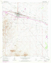
1963 Map of Lordsburg
USGS Topo · Published 1980About this map
Lordsburg serves as the focal point of this 1960s study, situated where the Southern Pacific railroad meets a landscape shaped by mining and overland travel. The map provides a remarkable intersection of transport history, showing the path of the Butterfield Trail as it passes near the Barney Stage Station (Site). To the southwest, the mining settlements of Shakespeare and Valedon occupy the hillsides, surrounded by named workings such as the Atwood-Hill Mine and Waldo Mine.
Find a feature on this map
28 named features on this map. Tap any name to fly to it.
Don’t see what you’re looking for? This feature index may not catch every label — zoom into the map to look around manually.
Map Details
Editions of this 1963 Lordsburg Map
Other maps of this area

1954 · Silver City
USGS Topo · 1:250,000

1958 · Silver City
USGS Topo · 1:250,000

1962 · Silver City
USGS Topo · 1:250,000

1962 · Lisbon
USGS Topo · 1:24,000

1963 · Lordsburg
USGS Topo · 1:24,000

1963 · Gold Hill
USGS Topo · 1:24,000

1963 · Culberson Ranch
USGS Topo · 1:24,000

1964 · Muir Ranch
USGS Topo · 1:24,000

1964 · Pyramid Peak
USGS Topo · 1:24,000

1964 · Gary
USGS Topo · 1:24,000