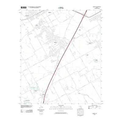
2010 Map of Lorena
USGS Topo · Published 2010About this map
Hewitt and Lorena sit at the center of this 2010 topographic record, illustrating the suburban expansion south of Waco. The landscape is defined by the convergence of several waterways, including the winding Bull Hide Creek, Castleman Creek, and Chambers Creek, which drain the prairie toward the southeast. This era of development is marked by a complex grid of residential streets such as Surrey Ridge Ln and Sun Valley Blvd, pushing into previously rural tracts. Notable landmarks like the Heathrow Airport and Waco Memorial Park are visible alongside critical water management infrastructure, specifically the numerous dams and reservoirs established by the Soil Conservation Service. For genealogists, the map preserves the location of the Lawson Cemetery, situated near the banks of Bull Hide Creek.
Find a feature on this map
64 named features on this map. Tap any name to fly to it.
Don’t see what you’re looking for? This feature index may not catch every label — zoom into the map to look around manually.
Map Details
Editions of this 2010 Lorena Map
This is the sole edition of this map. No revisions or reprints were ever made.
Other maps of this area

1892 · Temple
USGS Topo · 1:125,000

1892 · Waco
USGS Topo · 1:125,000

1920 · Waco
USGS Topo · 1:125,000

1924 · Waco 4-c
USGS Topo · 1:48,000

1924 · Waco 3-d
USGS Topo · 1:48,000

1931 · Valley Mills
USGS Topo · 1:62,500

1931 · Elm Mott
USGS Topo · 1:62,500

1931 · Mc Gregor
USGS Topo · 1:62,500

1954 · Waco
USGS Topo · 1:250,000

1955 · Waco
USGS Topo · 1:250,000