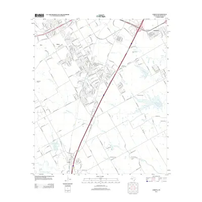
2013 Map of Lorena
USGS Topo · Published 2013About this map
The growing communities of Lorena and Robinson anchor this survey of McLennan County, Texas, just south of Waco. The landscape is defined by the convergence of several waterways, including Bull Hide Creek, Castleman Creek, and Cottonwood Creek, which meander through a mix of residential expansion and agricultural land. Regional aviation history is well-represented by several small airfields, such as Rabbit Run Airport and Smith Airport, alongside the more substantial Heathrow Airport. Genealogists and local historians will find the Lawson Cemetery and several memorial parks, including Waco Memorial Park and Chapel Hill Memorial Park, providing fixed points of community reference amid the suburban development of the early 21st century. The map also traces the smaller, established settlements of Atco and Ritchie, reflecting the area's transition into a more densely populated corridor.
Find a feature on this map
224 named features on this map. Tap any name to fly to it.
Don’t see what you’re looking for? This feature index may not catch every label — zoom into the map to look around manually.
Map Details
Editions of this 2013 Lorena Map
This is the sole edition of this map. No revisions or reprints were ever made.
Other maps of this area

1892 · Temple
USGS Topo · 1:125,000

1892 · Waco
USGS Topo · 1:125,000

1920 · Waco
USGS Topo · 1:125,000

1924 · Waco 4-c
USGS Topo · 1:48,000

1924 · Waco 3-d
USGS Topo · 1:48,000

1931 · Valley Mills
USGS Topo · 1:62,500

1931 · Elm Mott
USGS Topo · 1:62,500

1931 · Mc Gregor
USGS Topo · 1:62,500

1954 · Waco
USGS Topo · 1:250,000

1955 · Waco
USGS Topo · 1:250,000