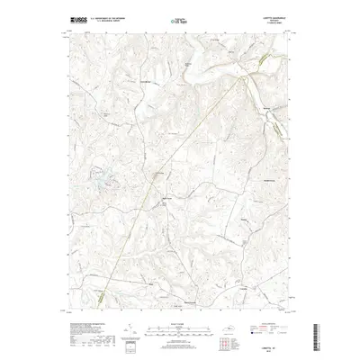
2019 Map of Loretto
USGS Topo · Published 2019About this map
Holy Cross and Loretto anchor this central Kentucky landscape, where the rolling knobs of the Outer Bluegrass meet the borders of Nelson, Washington, and Marion counties. The topography is defined by prominent elevations such as Rohan Knob and Pine Lick Knob, which rise above a network of waterways including Beech Fork and Pottinger Creek. This modern survey reveals a persistent rural settlement pattern characterized by small community clusters like Nerinx, Saint Francis, and Dant. For the local historian, the map identifies specific family and communal landmarks, from the Thomas Burying Ground near the center of the sheet to the Smocks Chapel Cemetery to the east. The intricate web of local routes, such as Wimsett Schoolhouse Road and Hagan School Road, reflects the agricultural and educational history of these small Kentucky townships.
Find a feature on this map
89 named features on this map. Tap any name to fly to it.
Don’t see what you’re looking for? This feature index may not catch every label — zoom into the map to look around manually.
Map Details
Editions of this 2019 Loretto Map
This is the sole edition of this map. No revisions or reprints were ever made.
Other maps of this area

1949 · Cravens
USGS Topo · 1:24,000

1949 · Shepherdsville
USGS Topo · 1:62,500

1953 · Howardstown
USGS Topo · 1:24,000

1953 · Loretto
USGS Topo · 1:24,000

1953 · Maud
USGS Topo · 1:24,000

1953 · Saint Catharine
USGS Topo · 1:24,000

1953 · Bardstown
USGS Topo · 1:24,000

1953 · New Haven
USGS Topo · 1:24,000

1953 · Raywick
USGS Topo · 1:24,000

1953 · Lebanon West
USGS Topo · 1:24,000