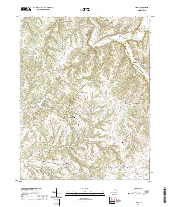
2022 Map of Loretto
USGS Topo · Published 2022About this map
Pottinger Creek and its many winding tributaries define this central Kentucky landscape, carving out the prominent elevations of Rohan Knob and Backbone Ridge. The region's deep Catholic heritage and early settlement history are reflected in the names of communities like Holy Cross, Saint Francis, and the motherhouse grounds at Nerinx. These established clusters are connected by a dense network of local roads such as Wimpsett Schoolhouse Road and Cissellville Road, tracing the ridgelines and hollows between the Nelson, Marion, and Washington county lines. Small family and community landmarks, including the Thomas Burying Ground and Smocks Chapel Cemetery, offer specific points of interest for genealogists tracking local lineages in the rural countryside near Loretto and Manton.
Find a feature on this map
91 named features on this map. Tap any name to fly to it.
Don’t see what you’re looking for? This feature index may not catch every label — zoom into the map to look around manually.
Map Details
Editions of this 2022 Loretto Map
This is the sole edition of this map. No revisions or reprints were ever made.
Other maps of this area

1949 · Cravens
USGS Topo · 1:24,000

1949 · Shepherdsville
USGS Topo · 1:62,500

1953 · Howardstown
USGS Topo · 1:24,000

1953 · Loretto
USGS Topo · 1:24,000

1953 · Maud
USGS Topo · 1:24,000

1953 · Saint Catharine
USGS Topo · 1:24,000

1953 · Bardstown
USGS Topo · 1:24,000

1953 · New Haven
USGS Topo · 1:24,000

1953 · Raywick
USGS Topo · 1:24,000

1953 · Lebanon West
USGS Topo · 1:24,000