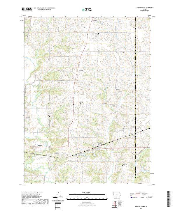
2022 Map of Lorimor South
USGS Topo · Published 2022About this map
Lorimor and the surrounding township lands in Union County are defined by a network of rural roads and watercourses. The landscape is segmented by the Union Co Clarke Co boundary, with the Thompson River and Fourmile Cr carving through the agricultural terrain. Significant for genealogical research, the area contains numerous burial sites including the Mount Pisgah Cem, Browns Mountain Cem, and West Union Cem. Small hubs like Thayer, Monette, and Talmage serve as anchors within this grid of named avenues and streets. Water features such as Thayer Lake and Wolf Cr provide focal points for the drainage of the region. The map illustrates a contemporary view of these Iowa communities, where the infrastructure of county roads like Co Rd H2R connects isolated farmsteads and historical landmarks.
Find a feature on this map
61 named features on this map. Tap any name to fly to it.
Don’t see what you’re looking for? This feature index may not catch every label — zoom into the map to look around manually.
Map Details
Editions of this 2022 Lorimor South Map
This is the sole edition of this map. No revisions or reprints were ever made.
Other maps of this area

1951 · Osceola
USGS Topo · 1:62,500

1951 · Afton
USGS Topo · 1:62,500

1954 · Centerville
USGS Topo · 1:250,000

1954 · Omaha
USGS Topo · 1:250,000

1954 · Des Moines
USGS Topo · 1:250,000

1955 · Nebraska City
USGS Topo · 1:250,000

1956 · Des Moines
USGS Topo · 1:250,000

1957 · Des Moines
USGS Topo · 1:250,000

1957 · Nebraska City
USGS Topo · 1:250,000

1957 · Omaha
USGS Topo · 1:250,000