
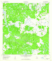
1944 Map of Lorraine
USGS Topo · Published 1944About this map
The Braden River winds through a landscape defined by marshes and sloughs just before the mid-century development of the Florida Gulf Coast. During the 1940s, this area was divided into administrative districts such as Precinct 25 and Precinct 16, showing a sparsely populated territory transitioning from wilderness to organized agriculture. Small settlements like Elwood Park and Lorraine are anchored by key infrastructure, including the Oneco Bridge and the Old RR Grade, which reflects the legacy of earlier timber or rail transport.
Find a feature on this map
22 named features on this map. Tap any name to fly to it.
Don’t see what you’re looking for? This feature index may not catch every label — zoom into the map to look around manually.
Map Details
Editions of this 1944 Lorraine Map
2 editions found
Other maps of this area

1921 · Fort De Soto
USGS Topo · 1:62,500

1944 · Sarasota
USGS Topo · 1:31,680

1944 · Rye
USGS Topo · 1:31,680

1944 · Verna
USGS Topo · 1:31,680

1944 · Ellenton
USGS Topo · 1:31,680

1944 · Parish
USGS Topo · 1:31,680

1944 · Miakka
USGS Topo · 1:31,680

1947 · Bradenton
USGS Topo · 1:24,000

1947 · Bee Ridge
USGS Topo · 1:24,000

1956 · Tampa
USGS Topo · 1:250,000