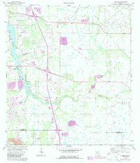
1973 Map of Lorraine
USGS Topo · Published 1987About this map
The Braden River meanders through this portion of Manatee County, serving as the central geographic feature for the small settlements of Elwood Park, Lorraine, and Linger Lodge. During the mid-1970s, the landscape was defined by a transition from traditional agricultural use toward modern infrastructure, evidenced by the presence of a Radio Tower, several substations, and a long Pipeline corridor. Notable local landmarks like Jiggs Landing and the Braden River Cem offer significant points of interest for genealogists tracing family roots in the area.
Find a feature on this map
30 named features on this map. Tap any name to fly to it.
Don’t see what you’re looking for? This feature index may not catch every label — zoom into the map to look around manually.
Map Details
Editions of this 1973 Lorraine Map
3 editions found
Other maps of this area

1921 · Fort De Soto
USGS Topo · 1:62,500

1944 · Sarasota
USGS Topo · 1:31,680

1944 · Rye
USGS Topo · 1:31,680

1944 · Verna
USGS Topo · 1:31,680

1944 · Lorraine
USGS Topo · 1:31,680

1944 · Ellenton
USGS Topo · 1:31,680

1944 · Parish
USGS Topo · 1:31,680

1944 · Miakka
USGS Topo · 1:31,680

1947 · Bradenton
USGS Topo · 1:24,000

1947 · Bee Ridge
USGS Topo · 1:24,000