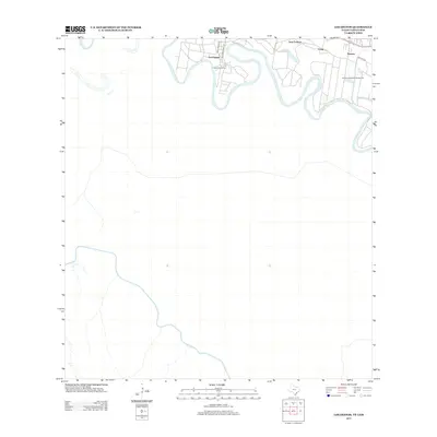
2013 Map of Los Ebanos
USGS Topo · Published 2013About this map
The International Ferry at Los Ebanos anchors this map, illustrating one of the final hand-drawn ferry crossings along the Rio Grande. This section of the border area, captured in the early 21st century, shows a landscape defined by the winding river and its associated land tracts, such as Antonio Vela Banco Number 53. The settlement patterns here follow historical thoroughfares like Military Rd, which connects the small communities of Havana, Crow, and Sam Fordyce. On the southern side of the river, the map details the terrain within Tamaulipas, Mexico, showcasing the cross-border geography of the region. The layout of streets in Los Ebanos, including Jose Garcia St and Felix Martinez Ave, reflects the local infrastructure that supports this unique international crossing point.
Find a feature on this map
10 named features on this map. Tap any name to fly to it.
Don’t see what you’re looking for? This feature index may not catch every label — zoom into the map to look around manually.
Map Details
Editions of this 2013 Los Ebanos Map
This is the sole edition of this map. No revisions or reprints were ever made.
Other maps of this area

1940 · Monte Christo
USGS Topo · 1:62,500

1949 · Mc Allen
USGS Topo · 1:250,000

1954 · McAllen
USGS Topo · 1:250,000

1956 · Garcias
USGS Topo · 1:62,500

1956 · Los Ebanos
USGS Topo · 1:62,500

1957 · Mc Allen
USGS Topo · 1:250,000

1962 · McAllen
USGS Topo · 1:250,000

1963 · La Joya
USGS Topo · 1:24,000

1963 · Citrus City
USGS Topo · 1:24,000

1965 · La Grulla
USGS Topo · 1:24,000