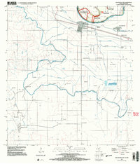
2002 Map of Los Ebanos NW
USGS Topo · Published 2003About this map
Rio Grande Rio Bravo serves as the focal point for this international border region, where the waters define the boundary between Starr County, Texas, and Tamaulipas, Mexico. The landscape is heavily shaped by an intricate irrigation system designed to support agriculture in the arid valley, featuring works like the Canal Principal Guillermo Rode, Canal Santa Gertrudis, and Canal Veintiocho. These waterways connect scattered ranching and farming settlements, including Valadeces and Los Villarreal, reflecting the deep-rooted Hispanic heritage and land-use patterns of the Lower Rio Grande Valley.
Find a feature on this map
43 named features on this map. Tap any name to fly to it.
Don’t see what you’re looking for? This feature index may not catch every label — zoom into the map to look around manually.
Map Details
Editions of this 2002 Los Ebanos NW Map
This is the sole edition of this map. No revisions or reprints were ever made.
Other maps of this area

1949 · Mc Allen
USGS Topo · 1:250,000

1954 · McAllen
USGS Topo · 1:250,000

1956 · Garcias
USGS Topo · 1:62,500

1956 · Los Ebanos
USGS Topo · 1:62,500

1956 · Escobares
USGS Topo · 1:62,500

1957 · Mc Allen
USGS Topo · 1:250,000

1962 · McAllen
USGS Topo · 1:250,000

1965 · Rio Grande City South
USGS Topo · 1:24,000

1965 · La Grulla
USGS Topo · 1:24,000
1965 · Sullivan City
USGS Topo · 1:24,000