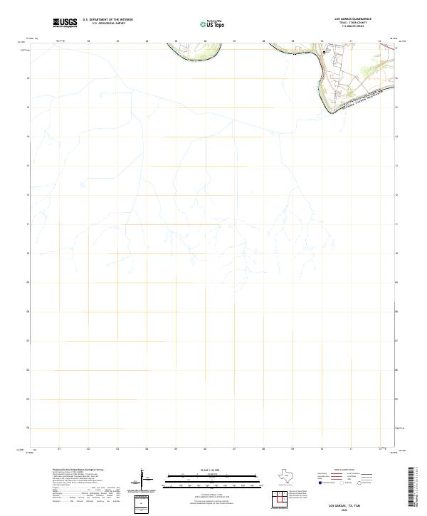
2022 Map of Los Garzas
USGS Topo · Published 2022About this map
The Rio Grande defines the northern edge of this Starr County landscape, where the international boundary between the United States and Mexico follows the river's winding course. This contemporary survey captures a sparsely populated borderland where local life is centered near the water, along corridors like S Midway Rd and Sepulveda Cir. Genealogy researchers will find the Los Garzas Cem positioned near the riverbank, accessed via Midway Cemetary Ln. The map illustrates a sharp contrast between the developed riparian corridor and the expansive, undeveloped terrain stretching south, marked only by occasional tracks and drainage patterns typical of the South Texas brush country.
Find a feature on this map
6 named features on this map. Tap any name to fly to it.
Don’t see what you’re looking for? This feature index may not catch every label — zoom into the map to look around manually.
Map Details
Editions of this 2022 Los Garzas Map
This is the sole edition of this map. No revisions or reprints were ever made.
Other maps of this area

1949 · Mc Allen
USGS Topo · 1:250,000

1954 · McAllen
USGS Topo · 1:250,000

1956 · Escobares
USGS Topo · 1:62,500

1956 · Roma
USGS Topo · 1:62,500

1957 · Mc Allen
USGS Topo · 1:250,000

1962 · McAllen
USGS Topo · 1:250,000

1965 · Rio Grande City South
USGS Topo · 1:24,000

1965 · Los Garzas
USGS Topo · 1:24,000
1965 · Rio Grande City North
USGS Topo · 1:24,000
1965 · Roma-Los Saenz East
USGS Topo · 1:24,000