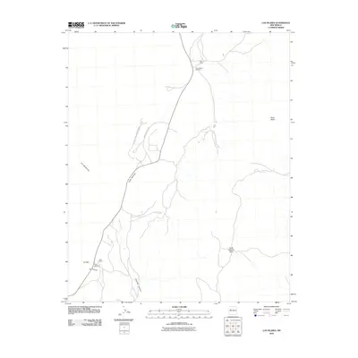
2010 Map of Los Pilares
USGS Topo · Published 2010About this map
El Malpais National Monument defines the western edge of this New Mexico landscape, where the high desert terrain transitions from the volcanic features of the monument toward the elevated plateaus. The topography is dominated by massive landforms such as North Cebollita Mesa and Mesa Negra, which overlook the winding path of Cebollita Creek. This area of Cibola County maintains its rural ranching character, evidenced by established holdings like Baca Ranch and Bibo Ranch. Strategic water sources in this arid environment are carefully noted, including Deer Spring and several critical pumps like the Las Ventanas Windmill. Small settlements and landmarks such as La Vieja and the namesake Los Pilares are positioned along the drainage of Cebollita Canyon, marking long-standing sites of human habitation in the high mesa country.
Find a feature on this map
15 named features on this map. Tap any name to fly to it.
Don’t see what you’re looking for? This feature index may not catch every label — zoom into the map to look around manually.
Map Details
Editions of this 2010 Los Pilares Map
This is the sole edition of this map. No revisions or reprints were ever made.
Other maps of this area

1883 · Mt. Taylor
USGS Topo · 1:250,000

1886 · Mt. Taylor
USGS Topo · 1:250,000

1892 · Mt. Taylor
USGS Topo · 1:250,000

1899 · Mt. Taylor
USGS Topo · 1:250,000

1917 · Broom Mountain
USGS Topo · 1:125,000

1954 · Socorro
USGS Topo · 1:250,000

1957 · San Rafael
USGS Topo · 1:24,000

1957 · Grants SE
USGS Topo · 1:24,000

1957 · Mc Cartys
USGS Topo · 1:24,000

1958 · Socorro
USGS Topo · 1:250,000