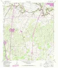
1958 Map of Losoya
USGS Topo · Published 1986About this map
Medina River and the San Antonio River converge in this corner of south Texas, shaping a landscape defined by seasonal creek beds and agrarian settlements. This area, primarily situated in Bexar County, shows the community of Losoya during a period of mid-century growth. Religious life is deeply rooted here, evidenced by several local landmarks including Our Lady of Mt Carmel Ch, Mt Carmel Chapel, and the Shady Oak Mission.
Find a feature on this map
20 named features on this map. Tap any name to fly to it.
Don’t see what you’re looking for? This feature index may not catch every label — zoom into the map to look around manually.
Map Details
Editions of this 1958 Losoya Map
Other maps of this area

1953 · Terrell Wells
USGS Topo · 1:24,000

1953 · Elmendorf
USGS Topo · 1:24,000

1953 · Southton
USGS Topo · 1:24,000

1954 · San Antonio
USGS Topo · 1:250,000

1957 · San Antonio
USGS Topo · 1:250,000

1958 · Losoya
USGS Topo · 1:24,000

1958 · Thelma
USGS Topo · 1:24,000

1958 · Saspamco
USGS Topo · 1:24,000
1964 · Saspamco SE
USGS Topo · 1:24,000

1964 · Leming
USGS Topo · 1:24,000