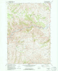
1994 Map of Lost Basin
USGS Topo · Published 1994About this map
Burnt River carves a deep path through this Baker County landscape, defining the central geography as it winds through a prominent Canyon. This high-desert terrain is marked by a complex network of resource extraction and water management, visible through numerous Prospects and Mines scattered across the ridges. Evidence of historical ranching and irrigation infrastructure is pervasive, including the Durkee Ditch and Chambeam Ditch which diverted water to the valley floor.
Find a feature on this map
37 named features on this map. Tap any name to fly to it.
Don’t see what you’re looking for? This feature index may not catch every label — zoom into the map to look around manually.
Map Details
Editions of this 1994 Lost Basin Map
This is the sole edition of this map. No revisions or reprints were ever made.
Other maps of this area

1901 · Baker City
USGS Topo · 1:125,000

1915 · Pine
USGS Topo · 1:125,000

1951 · Huntington
USGS Topo · 1:62,500

1955 · Baker
USGS Topo · 1:250,000

1957 · Durkee
USGS Topo · 1:62,500

1959 · Baker
USGS Topo · 1:250,000

1964 · Bridgeport
USGS Topo · 1:62,500

1967 · Encina
USGS Topo · 1:24,000

1967 · French Gulch
USGS Topo · 1:24,000

1967 · Lost Basin
USGS Topo · 1:24,000