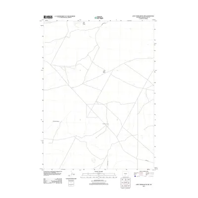
2012 Map of Lost Creek Butte NW
USGS Topo · Published 2012About this map
Old Osborne Cabin stands as a lonely human marker in this expansive high-desert corridor of Sweetwater County, Wyoming. The terrain is characterized by the sweeping depressions of the Lost Creek Basin and the shifting Little Sand Dunes in the north, illustrating the raw geological and environmental forces at play. This 2012 survey details a network of unpaved access routes including Red Desert Rd, Luman Rd, and BLM Road 3208, which crisscross the landscape to provide transit through the basin and around the distinct curve of Horseshoe Bend. The map documents the persistent Cattle and Bureau of Land Management presence in this remote interior, where modern infrastructure remains sparse and oriented toward resource management and navigation through the Red Desert.
Find a feature on this map
7 named features on this map. Tap any name to fly to it.
Don’t see what you’re looking for? This feature index may not catch every label — zoom into the map to look around manually.
Map Details
Editions of this 2012 Lost Creek Butte NW Map
This is the sole edition of this map. No revisions or reprints were ever made.
Other maps of this area

1954 · Rock Springs
USGS Topo · 1:250,000

1955 · Lander
USGS Topo · 1:250,000

1958 · Lander
USGS Topo · 1:250,000

1958 · Rock Springs
USGS Topo · 1:250,000

1960 · Red Lake
USGS Topo · 1:62,500

1960 · Lost Creek Butte
USGS Topo · 1:62,500

1960 · Five Fingers Butte
USGS Topo · 1:62,500

1960 · Lost Creek Lake
USGS Topo · 1:62,500

1961 · Lander
USGS Topo · 1:250,000

1962 · Rock Springs
USGS Topo · 1:250,000