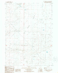
1989 Map of Lost Creek Butte NW
USGS Topo · Published 1989About this map
Lost Creek Basin defines this high desert landscape in Sweetwater County, where the terrain is marked by intermittent drainages and isolated outposts of human activity. The map focuses on the working infrastructure of the late 20th-century Wyoming ranching landscape, most notably the Luman Ranch. The presence of the Luman Ranch Road and various unimproved trails suggests a remote, cattle-driven economy where seasonal water sources and expansive grazing lands were the primary concerns. For researchers of western ranching history, the placement of ranch buildings and the surrounding land use patterns offer a grounded look at how families navigated the aridity of the basin floor before modern developments altered the region's traditional rhythms.
Find a feature on this map
3 named features on this map. Tap any name to fly to it.
Don’t see what you’re looking for? This feature index may not catch every label — zoom into the map to look around manually.
Map Details
Editions of this 1989 Lost Creek Butte NW Map
This is the sole edition of this map. No revisions or reprints were ever made.
Other maps of this area

1954 · Rock Springs
USGS Topo · 1:250,000

1955 · Lander
USGS Topo · 1:250,000

1958 · Lander
USGS Topo · 1:250,000

1958 · Rock Springs
USGS Topo · 1:250,000

1960 · Red Lake
USGS Topo · 1:62,500

1960 · Lost Creek Butte
USGS Topo · 1:62,500

1960 · Five Fingers Butte
USGS Topo · 1:62,500

1960 · Lost Creek Lake
USGS Topo · 1:62,500

1961 · Lander
USGS Topo · 1:250,000

1962 · Rock Springs
USGS Topo · 1:250,000