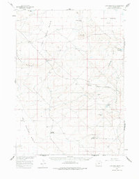
1960 Map of Lost Creek Butte
USGS Topo · Published 1978About this map
Lost Creek Basin and the surrounding high plains of the Red Desert Basin dominate this mid-century topographic record. The landscape is defined by its seasonal hydrology and livestock history, where intermittent water sources like Twentymile Hole and Lost Creek Butte Lake supported a network of isolated outposts. Ranching operations are clearly marked by the presence of the Buzzard Sheep Camp, Rasmussen Sheep Camp, and the Circle Bar Sheep Camp, indicating the significance of sheep herding in this part of Sweetwater County. The map also captures remnants of earlier habitation at the Old Osborne Cabin. Notable landforms such as Siberia Ridge and Dennison Cap break the steady grade of Battle Spring Flat, while scattered industrial markers like the Flowing Well point to the ongoing search for water and resources in this arid environment.
Find a feature on this map
20 named features on this map. Tap any name to fly to it.
Don’t see what you’re looking for? This feature index may not catch every label — zoom into the map to look around manually.
Map Details
Editions of this 1960 Lost Creek Butte Map
2 editions found

Other maps of this area

1954 · Rawlins
USGS Topo · 1:250,000

1954 · Rock Springs
USGS Topo · 1:250,000

1955 · Lander
USGS Topo · 1:250,000

1955 · Casper
USGS Topo · 1:250,000

1958 · Rawlins
USGS Topo · 1:250,000

1958 · Casper
USGS Topo · 1:250,000

1958 · Lander
USGS Topo · 1:250,000

1958 · Rock Springs
USGS Topo · 1:250,000

1960 · Red Lake
USGS Topo · 1:62,500

1960 · Battle Spring
USGS Topo · 1:24,000