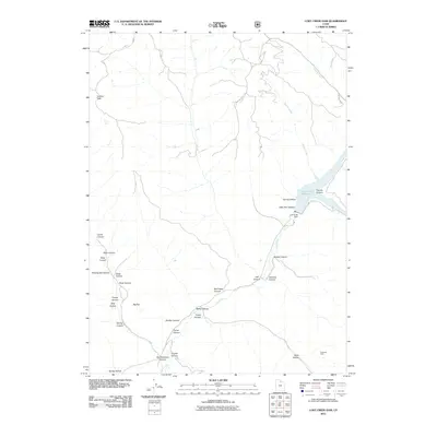
2011 Map of Lost Creek Dam
USGS Topo · Published 2011About this map
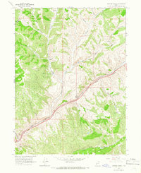
Lost Creek Reservoir dominates the eastern drainage of this Weber County landscape, held in place by the Lost Creek Dam. The terrain is defined by a series of steep drainages including Francis Canyon and Belnap Creek, which feed the reservoir from the north and east. To the west, the topography rises toward Guilder Peak, with numerous deep draws such as Wheatgrass Canyon and Soldier Canyon cutting through the highlands. A legacy of extraction is noted at the Robinson Mine near the southern boundary, while family-named features like Toone Canyon and Stokes Canyon suggest early land use and settlement patterns. The network of primitive roads, including Lost Creek Rd and Guildersleeve Rd, provides the primary access through these canyons and across the elevated plateau of Big Flat.
Find a feature on this map
33 named features on this map. Tap any name to fly to it.
Don’t see what you’re looking for? This feature index may not catch every label — zoom into the map to look around manually.
Map Details
Editions of this 2011 Lost Creek Dam Map
This is the sole edition of this map. No revisions or reprints were ever made.
Other maps of this area

1954 · Ogden
USGS Topo · 1:250,000

1958 · Ogden
USGS Topo · 1:250,000

1960 · Ogden
USGS Topo · 1:250,000
1961 · Devils Slide
USGS Topo · 1:24,000

1961 · Morgan
USGS Topo · 1:62,500

1964 · Lost Creek Dam
USGS Topo · 1:24,000

1964 · Francis Canyon
USGS Topo · 1:24,000
1964 · Henefer
USGS Topo · 1:24,000
1964 · Causey Dam
USGS Topo · 1:24,000
1964 · Heiners Creek
USGS Topo · 1:24,000