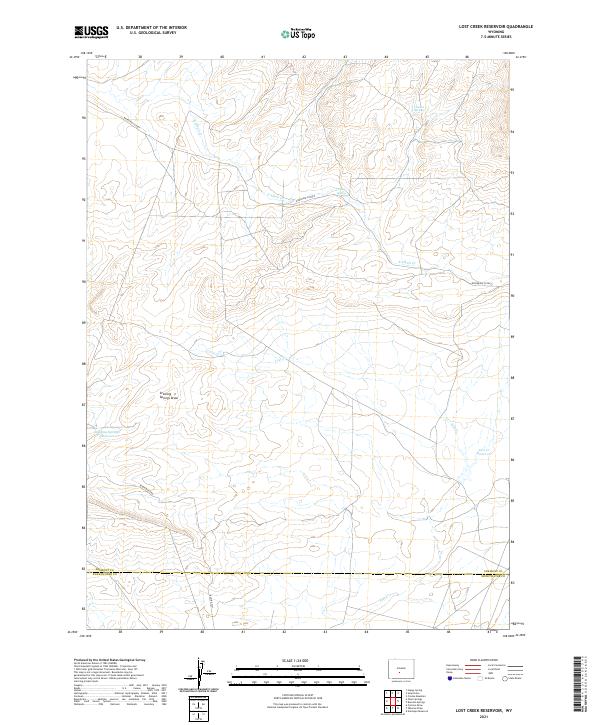
2021 Map of Lost Creek Reservoir
USGS Topo · Published 2021About this map
Lost Cr Reservoir and Stinking Springs Reservoir serve as the primary landmarks in this high-desert landscape on the border of Fremont and Sweetwater counties. The drainage patterns are defined by the winding course of Lost Cr and the ephemeral E Alkali Cr, which carve through the arid terrain. This area is characterized by its vital water sources, including Chicken Springs and Tierney Spring, which have historically supported livestock and wildlife in a region otherwise dominated by dry draws like Stinking Springs Draw. The human imprint on the land is represented by a network of remote corridors such as the Riverview Cutoff and Bison Basin Rd, providing essential access across the open range of the Red Desert region. The map captures the specialized hydrology and survey grid of a territory where water management remains the central driver of land use.
Find a feature on this map
17 named features on this map. Tap any name to fly to it.
Don’t see what you’re looking for? This feature index may not catch every label — zoom into the map to look around manually.
Map Details
Editions of this 2021 Lost Creek Reservoir Map
This is the sole edition of this map. No revisions or reprints were ever made.
Other maps of this area

1951 · Soap Holes
USGS Topo · 1:24,000

1951 · Crooks Mountain
USGS Topo · 1:24,000

1953 · Happy Spring
USGS Topo · 1:24,000

1955 · Lander
USGS Topo · 1:250,000

1955 · Casper
USGS Topo · 1:250,000

1958 · Casper
USGS Topo · 1:250,000

1958 · Lander
USGS Topo · 1:250,000

1960 · Lost Creek Lake
USGS Topo · 1:62,500

1961 · Lander
USGS Topo · 1:250,000
1961 · Lost Creek Reservoir
USGS Topo · 1:24,000