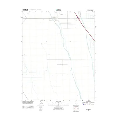
2012 Map of Lost Hills
USGS Topo · Published 2012About this map
The Governor Edmund G Brown California Aqueduct dominates this Central Valley landscape, cutting a diagonal path through the arid terrain of Kern County. This 2012 survey illustrates the vital water infrastructure of the region, where the aqueduct meets other significant waterways like the Kern River Channel and the West Side Canal. The settlement pattern is largely defined by a grid of industrial and agricultural transport routes, including Brown Material Rd and Holloway Rd, centered around the small aviation hub at Lost Hills- Kern County Airport. Located just north of the town center, the airport and nearby streets such as Universal St and King St highlight the intersection of regional transit and heavy utility corridors that sustain the local economy.
Find a feature on this map
15 named features on this map. Tap any name to fly to it.
Don’t see what you’re looking for? This feature index may not catch every label — zoom into the map to look around manually.
Map Details
Editions of this 2012 Lost Hills Map
This is the sole edition of this map. No revisions or reprints were ever made.
Other maps of this area

1912 · McKittrick
USGS Topo · 1:125,000

1914 · Lost Hills
USGS Topo · 1:125,000

1927 · Semitropic
USGS Topo · 1:31,680

1930 · Miramonte Ranch
USGS Topo · 1:31,680

1931 · Lokern
USGS Topo · 1:31,680

1931 · Goose Lake
USGS Topo · 1:31,680

1932 · Antelope Plain
USGS Topo · 1:31,680

1932 · West of Goose Lake
USGS Topo · 1:31,680

1932 · Reynolds Ranch
USGS Topo · 1:31,680

1934 · Lokern
USGS Topo · 1:31,680