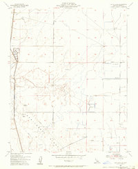
1954 Map of Lost Hills NE
USGS Topo · Published 1956About this map
Semitropic Ridge rises across this Kern County landscape, defining the topography in an area characterized by industrial activity and private sporting grounds during the mid-1950s. The western edge is dominated by the Goose Lake Canal and its associated levee, supporting a complex network of infrastructure including a notable Pumping Station and several Pipelines that traverse the terrain. While Cole Ranch stands as a primary named property, the sheet is most distinguished by its concentration of specialized recreational sites.
Find a feature on this map
17 named features on this map. Tap any name to fly to it.
Don’t see what you’re looking for? This feature index may not catch every label — zoom into the map to look around manually.
Map Details
Editions of this 1954 Lost Hills NE Map
2 editions found
Other maps of this area

1914 · Lost Hills
USGS Topo · 1:125,000

1927 · Semitropic
USGS Topo · 1:31,680

1929 · Hacienda Ranch
USGS Topo · 1:31,680

1929 · Allensworth
USGS Topo · 1:31,680

1930 · Leonards
USGS Topo · 1:31,680

1930 · Hamlin School
USGS Topo · 1:31,680

1930 · Miramonte Ranch
USGS Topo · 1:31,680

1931 · Goose Lake
USGS Topo · 1:31,680

1932 · West of Goose Lake
USGS Topo · 1:31,680

1932 · Reynolds Ranch
USGS Topo · 1:31,680