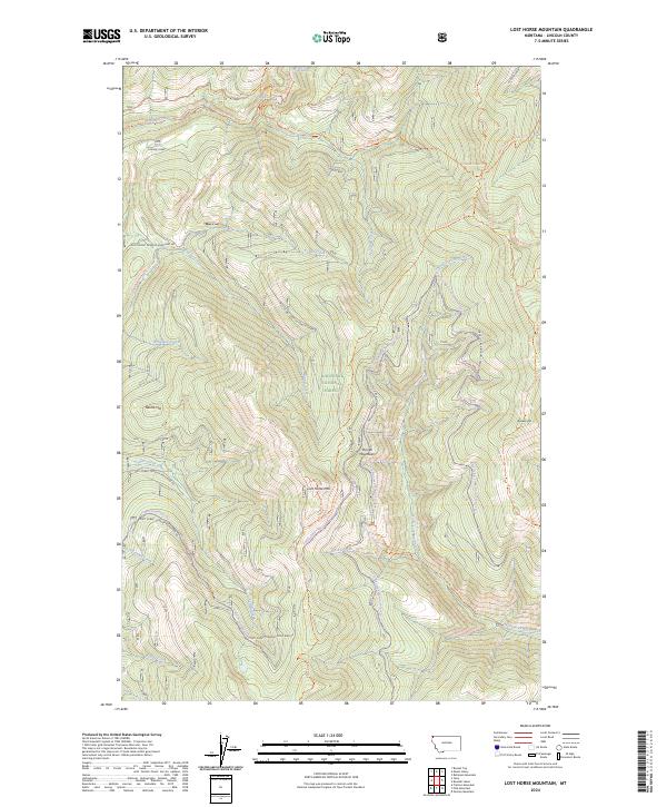
2024 Map of Lost Horse Mountain
USGS Topo · Published 2024About this map
Lost Horse Mtn stands at the center of this mountain landscape within the Kootenai National Forest of Lincoln County. The drainage patterns of the Purcell Mountains are meticulously detailed, showing the convergence of Vinal Creek and Turner Creek as they cut through the high country. This modern survey emphasizes recreational and forest management infrastructure, illustrating a complex network of multi-use pathways such as the Pacific Northwest National Scenic Trl and the Fowler Snowmobile Trl.
Find a feature on this map
36 named features on this map. Tap any name to fly to it.
Don’t see what you’re looking for? This feature index may not catch every label — zoom into the map to look around manually.
Map Details
Editions of this 2024 Lost Horse Mountain Map
This is the sole edition of this map. No revisions or reprints were ever made.
Other maps of this area

1957 · Kalispell
USGS Topo · 1:250,000

1960 · Kalispell
USGS Topo · 1:250,000

1961 · Kalispell
USGS Topo · 1:250,000

1963 · Yaak
USGS Topo · 1:24,000

1963 · Robinson Mountain
USGS Topo · 1:24,000

1963 · Pink Mountain
USGS Topo · 1:24,000

1963 · Boulder Lakes
USGS Topo · 1:24,000

1963 · Bonnet Top
USGS Topo · 1:24,000

1963 · Mount Henry
USGS Topo · 1:24,000
1963 · Flatiron Mountain
USGS Topo · 1:24,000