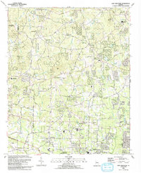
1992 Map of Lost Mountain
USGS Topo · Published 1993About this map
Picketts Mill State Historical Site sits along the northwestern boundary of this survey, marking a significant Civil War location on the Paulding Co Cobb Co line. The landscape is defined by the prominent height of Lost Mtn and the winding courses of Allatoona Creek and Mud Creek. By the early 1990s, this area reflects a suburban transition, with numerous schools such as the John McEachern High Sch and Pine Mountain Middle Sch serving established communities like Due West and Macland.
Find a feature on this map
64 named features on this map. Tap any name to fly to it.
Don’t see what you’re looking for? This feature index may not catch every label — zoom into the map to look around manually.
Map Details
Editions of this 1992 Lost Mountain Map
This is the sole edition of this map. No revisions or reprints were ever made.
Other maps of this area

1890 · Cartersville
USGS Topo · 1:125,000

1891 · Marietta
USGS Topo · 1:125,000

1891 · Cartersville
USGS Topo · 1:125,000

1895 · Marietta
USGS Topo · 1:125,000

1896 · Cartersville
USGS Topo · 1:125,000

1897 · Marietta
USGS Topo · 1:125,000

1901 · Marietta
USGS Topo · 1:125,000

1906 · Stilesboro
USGS Topo · 1:62,500

1907 · Acworth
USGS Topo · 1:62,500

1908 · Stilesboro
USGS Topo · 1:62,500